| Mouth |
| MORE INFORMATION |
|
|
|
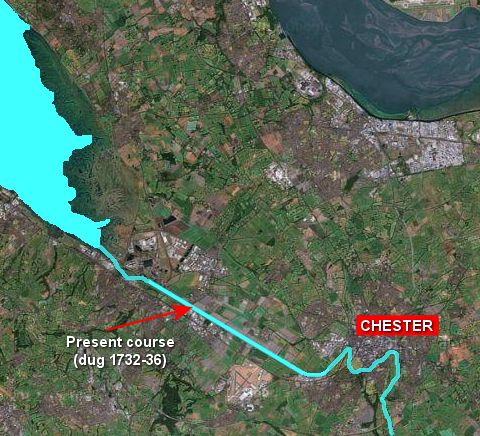
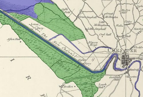
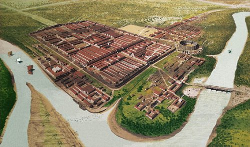
| The Shrinking River Dee The River Dee was once much wider to the west of Chester, and quite large ships were able to sail right up to the city walls in Roman times. Over the centuries, however, the Dee Estuary filled up with mud and silt, and larger ships could no longer reach the city. This made Neston and Parkgate into successful small ports, with many ships sailing from there to Ireland. In 1732, Dutch engineers were given the job of building a new channel for the River Dee by local merchants and Chester Corporation. This was to make it easier for ships to reach Chester, and to reduce the silting up of the river. The straight section of the river channel they built, which leads to the mouth, is easy to see on the maps below - it is 5 miles long, and was called The New Channel when it was opened. However, the silting up continued, and the newer port of Liverpool soon became much more important than Chester, because much larger ships could sail up the River Mersey. |
||||||||||||||
|
||||||||||||||
|
||||||||||||||
|
||||||||||||||
| Sources: Old Port View from Chester: A Virtual Stroll Around the Walls Chester/Cheshire maps from Cheshire Local History Association Other maps from Google Maps Model of Roman Chester from Sarah Woodbury: novelist Wikipedia |